

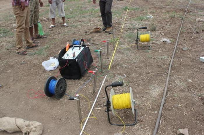
Hydrogeological Survey in Kenya | Borehole Siting & Groundwater Survey by Pacq Borehole Drillers
Professional Hydrogeological Survey Services in Kenya
Are you planning to drill a borehole and looking for a professional hydrogeological survey in Kenya? Pacq Borehole Drillers provides hydrogeological survey coordination and groundwater assessment services to support residential, agricultural, commercial, institutional and industrial water projects.
A successful borehole project begins with proper planning. Before investing in drilling equipment, casing, pumps and water infrastructure, it is important to understand the groundwater potential and geological conditions of the proposed site.
A hydrogeological survey helps assess the subsurface conditions of a property and provides important information to support borehole siting, drilling depth estimates and groundwater development planning.
At Pacq Borehole Drillers, we help clients understand the process of developing a borehole, from the initial site assessment and hydrogeological survey to borehole drilling, test pumping, water quality testing, pump installation and complete water supply solutions.
Whether you are planning a borehole for a home, apartment, farm, school, hotel, hospital, factory, estate or commercial property, a professional hydrogeological survey can be an important first step.
What Is a Hydrogeological Survey?
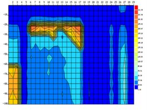
A hydrogeological survey is an assessment of the geological and groundwater conditions of a particular location.
The purpose of the survey is to gather information that can help determine the groundwater potential of the site and support the planning of a borehole project.
Depending on the scope of the project and site conditions, a hydrogeological survey may involve the assessment of:
- Local geology
- Rock formations
- Groundwater occurrence
- Existing boreholes in the area
- Surface features
- Aquifer characteristics
- Topography
- Drainage patterns
- Geological structures
- Fractures and faults
- Potential groundwater recharge areas
- Site accessibility
- Proposed water demand
The information collected can help guide the selection of a suitable location for drilling and support the preparation of a borehole development plan.
A hydrogeological survey does not simply involve identifying an open space and drilling. Groundwater conditions are influenced by geological formations and other environmental factors, and these conditions can vary significantly from one location to another.
Why Do You Need a Hydrogeological Survey Before Drilling a Borehole?
Drilling a borehole is a significant investment.
Depending on the location, depth and system requirements, a complete borehole project can involve substantial costs for:
- Professional assessment
- Borehole drilling
- Casing
- Development
- Test pumping
- Water analysis
- Submersible pumps
- Solar or electrical systems
- Water tanks
- Plumbing and distribution
A hydrogeological survey helps provide information before these major investments are made.
Key Benefits of a Hydrogeological Survey
1. Supports Borehole Siting
One of the main purposes of the survey is to identify a potentially suitable location for borehole drilling.
The survey considers geological and groundwater conditions to support the selection of a drilling point.
2. Helps with Borehole Planning
The assessment can provide useful information for planning the drilling project.
This may include preliminary recommendations relating to:
- Proposed drilling location
- Estimated groundwater conditions
- Potential drilling depth
- Geological formations
- Expected aquifer zones
- Borehole design considerations
3. Reduces Guesswork
Drilling without proper site assessment can result in unnecessary uncertainty.
A hydrogeological survey provides professional information to support project planning.
4. Supports Technical Decision-Making
The survey can provide information useful to:
- Homeowners
- Farmers
- Developers
- Engineers
- Architects
- Contractors
- Institutions
- Commercial property owners
5. Helps Plan the Complete Water System
The expected groundwater conditions and proposed water demand can influence decisions relating to:
- Borehole depth
- Pump selection
- Storage capacity
- Water treatment
- Solar pumping
- Irrigation systems
- Distribution infrastructure
Hydrogeological Survey Cost in Kenya
One of the most common questions property owners ask is:
How much does a hydrogeological survey cost in Kenya?
The cost of a hydrogeological survey depends on several factors, including the location, size of the property, accessibility, professional requirements and scope of the assessment.
For planning purposes, a hydrogeological survey in Kenya may cost approximately KSh 40,000 to KSh 150,000 or more, depending on the complexity of the project.
The final cost may be influenced by:
- Location of the property
- Distance and travel requirements
- Site accessibility
- Size of the study area
- Geological complexity
- Availability of existing groundwater information
- Geophysical survey requirements
- Professional report preparation
- Project-specific documentation
The following table provides indicative planning prices.
| Hydrogeological Survey Service | Indicative Price Range |
|---|---|
| Basic site consultation | KSh 5,000 – 20,000+ |
| Hydrogeological survey | KSh 40,000 – 150,000+ |
| Borehole siting assessment | KSh 30,000 – 100,000+ |
| Geophysical groundwater investigation | KSh 50,000 – 200,000+ |
| Large commercial project survey | Site-specific quotation |
| Farm or agricultural assessment | Site-specific quotation |
| Additional travel and field costs | Depends on location |
| Technical report and recommendations | Depends on project scope |
Important: These are indicative price ranges for planning purposes only. The actual cost depends on the specific property and project requirements.
Contact Pacq Borehole Drillers for a site-specific hydrogeological survey quotation.
What Does a Hydrogeological Survey Include?
The exact scope of a hydrogeological survey can vary from one project to another.
A typical assessment may include the following stages.
1. Initial Consultation
The project begins with an understanding of the client’s requirements.
Information may include:
- Property location
- County
- Property size
- Intended use of water
- Estimated water demand
- Type of development
- Existing water sources
- Nearby boreholes
- Planned irrigation or commercial activities
This information helps determine the appropriate scope of the assessment.
2. Desktop Study
Available information about the area may be reviewed.
This can include:
- Geological information
- Hydrogeological information
- Maps
- Existing borehole data
- Topographical information
- Previous studies where available
The purpose is to develop an understanding of the conditions surrounding the proposed project area.
3. Site Visit
A physical inspection of the property may be carried out.
The assessment can consider:
- Surface geology
- Topography
- Drainage
- Access
- Existing structures
- Land use
- Nearby water sources
- Potential borehole locations
Site conditions can influence both borehole siting and the practical requirements for bringing drilling equipment onto the property.
4. Geological Assessment
The geological conditions of an area play an important role in groundwater occurrence.
The assessment may consider:
- Rock types
- Weathered zones
- Fractures
- Faults
- Geological contacts
- Surface formations
Groundwater may occur in different geological environments, and the assessment helps build a clearer understanding of the site.
5. Geophysical Investigation
Where required, geophysical methods can be used to investigate subsurface conditions.
A geophysical survey may provide additional information about variations beneath the ground surface.
The information can support the identification of potential groundwater-bearing zones and geological structures.
The appropriate investigation depends on the site conditions and project requirements.
6. Borehole Siting
Based on the information collected, a proposed borehole location may be recommended.
The final location should also consider practical factors such as:
- Accessibility for the drilling rig
- Distance from buildings
- Existing infrastructure
- Potential sources of contamination
- Future property development
- Water distribution requirements
A technically promising location is only useful if the drilling equipment can safely access the site.
7. Technical Report and Recommendations
The survey findings may be compiled into a professional report.
Depending on the project requirements, recommendations may address:
- Proposed drilling location
- Geological conditions
- Groundwater potential
- Estimated drilling depth
- Recommended borehole design considerations
- Proposed water development approach
The report can form an important part of planning the next stages of the borehole project.
Hydrogeological Survey Process
Pacq Borehole Drillers follows a structured approach to groundwater project planning.
| Step | Activity | Purpose |
|---|---|---|
| 1 | Client consultation | Understand water requirements |
| 2 | Project information collection | Review site and development details |
| 3 | Desktop assessment | Review available geological information |
| 4 | Site visit | Inspect physical conditions |
| 5 | Geological assessment | Understand subsurface conditions |
| 6 | Geophysical investigation | Investigate potential groundwater zones where required |
| 7 | Borehole siting | Recommend a suitable drilling location |
| 8 | Technical reporting | Document findings and recommendations |
| 9 | Project planning | Prepare for drilling and water development |
The actual process may vary depending on the size and complexity of the project.
Hydrogeological Survey for Borehole Drilling
A hydrogeological survey is particularly important for clients planning borehole drilling in Kenya.
The survey can help answer important questions such as:
- Where should the borehole be drilled?
- What geological formations are expected?
- What depth may need to be investigated?
- What groundwater potential exists?
- What type of borehole construction may be appropriate?
- What equipment may be required?
- What should the client budget for?
- What additional water infrastructure may be needed?
It is important to understand that groundwater conditions can vary.
A nearby property may have a successful borehole, but this does not automatically mean that another property will encounter water at the same depth or under identical conditions.
Each borehole project should therefore be assessed according to its specific location and requirements.
Hydrogeological Survey vs Borehole Drilling
A hydrogeological survey and borehole drilling are different stages of a groundwater development project.
| Hydrogeological Survey | Borehole Drilling |
|---|---|
| Assesses groundwater conditions | Physically creates the borehole |
| Supports borehole siting | Reaches geological formations below ground |
| Provides planning information | Develops access to groundwater |
| May recommend drilling depth | Determines actual formations encountered |
| Conducted before major drilling investment | Takes place after planning and required processes |
| Supports project design | Creates the water source |
The survey provides information for planning, while drilling provides the actual field results.
For the best results, the two stages should be properly coordinated.
Hydrogeological Survey for Residential Properties
Homeowners may require a borehole to improve water reliability and reduce dependence on alternative water sources.
A residential hydrogeological survey can support projects involving:
- Private homes
- Villas
- Apartments
- Gated communities
- Residential estates
- Rental properties
- Gardens
- Landscaping
Before planning the system, homeowners should consider:
- Number of residents
- Number of housing units
- Daily water demand
- Garden irrigation
- Future development
- Storage capacity
- Preferred pumping system
The survey and subsequent borehole testing can help provide information needed to plan an appropriate water supply system.
Hydrogeological Survey for Farms
Agricultural projects can have significant water requirements.
Pacq Borehole Drillers can support hydrogeological survey planning for:
- Irrigation farms
- Greenhouses
- Horticultural projects
- Dairy farms
- Livestock farms
- Poultry farms
- Fish farming
- Flower farms
- Commercial agriculture
Farm owners should consider the entire water demand, including:
- Crop requirements
- Irrigation methods
- Livestock consumption
- Processing requirements
- Storage
- Seasonal demand
A successful farm water project should be planned as a complete system.
Example:
Groundwater Source → Borehole → Pump → Solar/Electric Power → Storage → Irrigation System
The survey is the first stage in understanding the potential groundwater source.
Hydrogeological Survey for Commercial and Institutional Projects
Large properties may require significant volumes of water.
Pacq Borehole Drillers can support projects for:
- Schools
- Hospitals
- Hotels
- Apartments
- Office buildings
- Factories
- Warehouses
- Churches
- Shopping centres
- Real estate developments
Commercial projects may require a more detailed assessment because the consequences of an inadequate water supply can be significant.
The project planning process may need to consider:
- Current water demand
- Peak water demand
- Future expansion
- Storage requirements
- Water treatment
- Pumping requirements
- Backup systems
- Distribution infrastructure
Factors That Affect Hydrogeological Survey Pricing
Location
Properties located far from operational centres may require additional travel and field costs.
Site Accessibility
Difficult terrain may increase the time and resources required for the assessment.
Project Size
A large agricultural or commercial development may require a more detailed investigation than a small residential plot.
Geological Complexity
Some areas may require additional assessment because of complex geological conditions.
Geophysical Requirements
The use of specialised geophysical investigations can affect the total survey cost.
Professional Documentation
Different projects may require different levels of reporting and technical documentation.
Estimated Hydrogeological Survey Cost by Project Type
The following table provides general planning estimates.
| Project Type | Indicative Survey Cost |
|---|---|
| Residential property | KSh 40,000 – 100,000+ |
| Small farm | KSh 50,000 – 120,000+ |
| Large farm | KSh 80,000 – 200,000+ |
| Apartment development | KSh 60,000 – 150,000+ |
| School or institution | KSh 60,000 – 180,000+ |
| Commercial property | KSh 80,000 – 250,000+ |
| Industrial project | Site-specific quotation |
| Large development project | Site-specific quotation |
The actual cost should always be confirmed through a project-specific quotation.
How Long Does a Hydrogeological Survey Take?
The duration depends on the location, property size and complexity of the investigation.
A relatively straightforward project may be completed faster than a large commercial or agricultural assessment requiring additional fieldwork and technical analysis.
The complete process can involve:
- Initial consultation
- Data review
- Site visit
- Field assessment
- Geophysical investigation where required
- Analysis
- Report preparation
Clients planning to drill a borehole should begin the survey process early enough to allow for proper project planning.
Can a Hydrogeological Survey Guarantee Water?
No professional groundwater assessment should guarantee that a specific volume of water will be found before drilling.
A hydrogeological survey provides professional information and recommendations based on the available geological, hydrogeological and field data.
However, subsurface conditions involve uncertainty.
The actual geological formations, groundwater occurrence and borehole yield are confirmed during drilling and testing.
A professional survey can help improve decision-making and reduce unnecessary guesswork, but it should not be presented as an absolute guarantee of water.
What Happens After the Hydrogeological Survey?
Once the hydrogeological survey is completed, the next steps may include project planning and the applicable processes required before drilling.
The project may then move through the following stages:
Step 1: Hydrogeological Survey
Assess the groundwater and geological conditions.
Step 2: Project Planning
Review the recommendations and plan the proposed borehole.
Step 3: Required Documentation and Approvals
Proceed with the applicable processes and requirements for groundwater development.
Step 4: Borehole Drilling
Mobilise the drilling equipment and begin drilling.
Step 5: Borehole Construction
Install appropriate casing and complete the borehole according to the conditions encountered.
Step 6: Borehole Development
Remove fine materials and prepare the borehole for testing.
Step 7: Test Pumping
Assess borehole performance and support pump selection.
Step 8: Water Quality Testing
Analyse the water quality and identify any treatment requirements.
Step 9: Pump Installation
Install a suitable submersible or other pumping system.
Step 10: Water Storage and Distribution
Connect the system to tanks, irrigation, buildings or other water distribution infrastructure.
Complete Borehole and Water Solutions
Pacq Borehole Drillers offers more than hydrogeological survey support.
Our goal is to help clients develop complete water solutions.
Our services include:
- Hydrogeological surveys
- Borehole siting
- Groundwater assessment
- Borehole drilling
- Borehole casing
- Borehole development
- Test pumping
- Water quality testing
- Borehole pump installation
- Solar water pumps
- Water storage
- Irrigation water systems
- Water distribution
- Borehole rehabilitation
- Water pump maintenance
This integrated approach allows clients to plan their projects from the initial assessment through to a functional water supply system.
Why Choose Pacq Borehole Drillers?
Choosing the right company for your groundwater project is important.
Pacq Borehole Drillers focuses on helping clients understand the complete process.
Professional Project Planning
We help clients start with proper assessment and planning.
Complete Water Solutions
Our services extend beyond borehole drilling to include pumping, solar and water storage solutions.
Residential, Agricultural and Commercial Projects
We support a wide range of water projects.
Project-Specific Approach
Every property has different geological conditions and water requirements.
Transparent Quotation Process
We encourage clear project scopes and site-specific pricing.
Areas We Serve
Pacq Borehole Drillers provides hydrogeological survey and borehole water solutions for projects across Kenya, subject to operational coverage and project requirements.
Our service areas include:
- Nairobi
- Kiambu
- Kajiado
- Machakos
- Nakuru
- Naivasha
- Narok
- Nyeri
- Murang’a
- Meru
- Embu
- Laikipia
- Kisumu
- Uasin Gishu
- Mombasa
- Kilifi
- Kwale
- Kakamega
- Other areas across Kenya
Contact us to discuss your specific project location.
Frequently Asked Questions About Hydrogeological Surveys in Kenya
1. What is a hydrogeological survey?
A hydrogeological survey is an assessment of geological and groundwater conditions to support borehole siting and groundwater development planning.
2. How much does a hydrogeological survey cost in Kenya?
The cost can vary depending on the location and project scope. For planning purposes, prices may range from approximately KSh 40,000 to KSh 150,000 or more, depending on the assessment requirements.
3. Is a hydrogeological survey required before borehole drilling?
A hydrogeological assessment is an important part of borehole planning and may also support the applicable groundwater development processes. Requirements can vary depending on the project.
4. How long does a hydrogeological survey take?
The duration depends on the size, location and complexity of the project. Site assessment, data analysis and report preparation all affect the completion period.
5. Can a hydrogeological survey guarantee water?
No. A survey provides professional analysis and recommendations, but actual groundwater conditions and borehole performance can only be confirmed through drilling and testing.
6. What is borehole siting?
Borehole siting is the process of identifying and recommending a suitable location for drilling based on geological, hydrogeological and practical site considerations.
7. What is a groundwater survey?
A groundwater survey is an assessment designed to investigate the occurrence and potential of groundwater in a specific area.
8. What is a geophysical survey?
A geophysical survey uses specialised methods to investigate subsurface conditions and can support groundwater exploration and borehole siting.
9. Can you conduct a hydrogeological survey for a farm?
Yes. Hydrogeological assessments can support agricultural projects, including irrigation, livestock and commercial farming.
10. Can you conduct a hydrogeological survey for a home?
Yes. Homeowners planning borehole projects can use hydrogeological assessment to support project planning and borehole siting.
11. What information do I need to request a survey?
Useful information includes your location, county, property type, intended use of water, estimated water demand and details of any existing water sources or nearby boreholes.
12. What happens after the survey?
The next stages may include project planning, applicable documentation and approvals, borehole drilling, development, testing, water analysis, pump installation and water distribution.
13. How deep will my borehole be?
The expected depth can be estimated during project planning, but actual drilling depth depends on the geological conditions encountered on site.
14. Does the survey price include borehole drilling?
No. A hydrogeological survey and borehole drilling are separate services. The survey supports planning, while drilling involves the physical construction of the borehole.
15. Can Pacq Borehole Drillers provide a complete borehole solution?
Yes. Pacq Borehole Drillers can support projects from hydrogeological survey and borehole siting through drilling, testing, pump installation, solar systems and water storage solutions.
Request a Hydrogeological Survey Quote Today
Are you planning a borehole for your home, farm, school, apartment, hotel, business or development project?
Start with a professional hydrogeological survey in Kenya.
To request a quotation from Pacq Borehole Drillers, provide:
| Information | Why It Helps |
|---|---|
| Property location | Helps plan the assessment |
| County and town | Supports project planning |
| Property type | Helps understand water demand |
| Intended water use | Supports system design |
| Estimated water requirement | Helps determine project scale |
| Land size | Provides project context |
| Existing water sources | Helps with assessment |
| Nearby borehole information | Can provide useful local context |
| Site access details | Helps plan fieldwork |
Get Started with Pacq Borehole Drillers
Pacq Borehole Drillers provides professional support for clients planning groundwater and borehole projects across Kenya.
Our Hydrogeological Survey Services Include:
Groundwater Assessment | Borehole Siting | Hydrogeological Surveys | Geophysical Investigation Coordination | Borehole Project Planning | Borehole Drilling | Test Pumping | Water Testing | Pump Installation | Solar Water Pumps
Pacq Borehole Drillers
Professional Hydrogeological Survey & Borehole Water Solutions in Kenya
Contact Pacq Borehole Drillers today to request a hydrogeological survey quotation and take the first step toward planning a reliable water supply for your property.